The word, ‘topography’ refers to the classification and distinction of natural and man-made structures on a particular area of land. While certain elevation on the land that might denote hills, rivers, mountains, valleys, etc. are shown through contours, numbers, or certain points. The contours are markings of different colors to highlight certain parts from others. All these features make the study of a topographical map which can be used for multiple purposes. A detailed discussion is given below to help you get a good brief idea about topographical studies.
Creating A Topographical Study
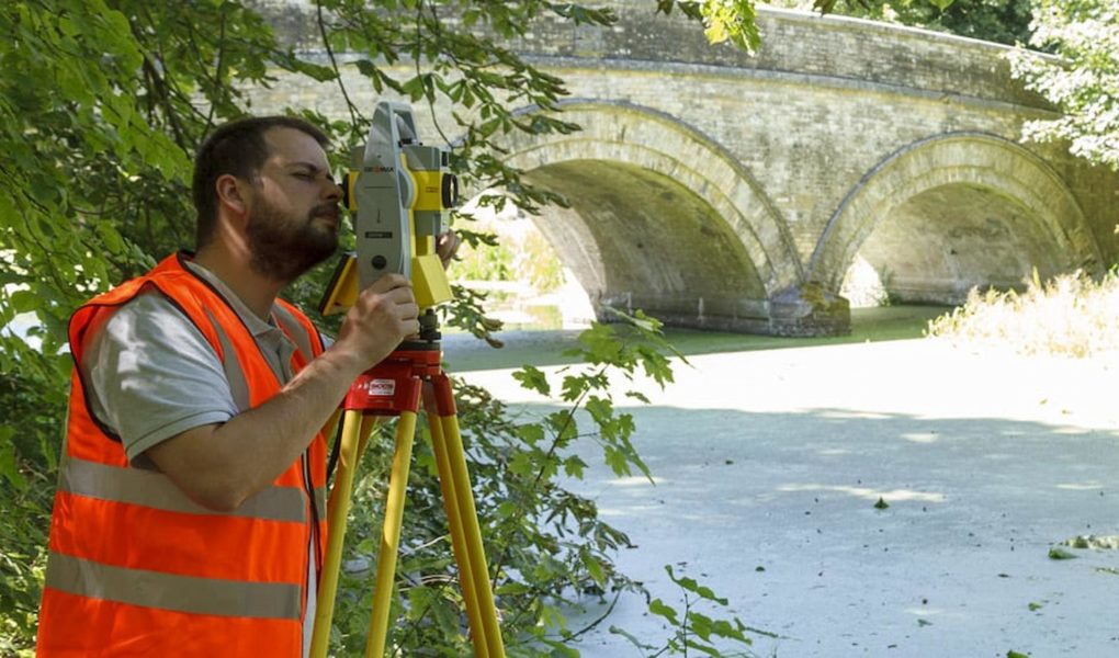
Topographical studies are created by professional surveyors and engravers. The skilled team also includes fact checkers, printers, and others to accurately design a particular area map. The technology plays a vital part in measuring the distance. Tools like GPS units, Robotic total station instruments, and laser scanning equipment are used to make work easier and efficient. There are different types of topographical surveys that are made according to specific requirements for mapping boundaries, lands, and even construction projects. Important steps follow:
- Obtaining information about the type of land to be surveyed, what details are to be included, including accuracy measures, data etc. and planning accordingly
- Time and price calculation
- Collection of data on-site
- Working on data to create survey reports
- Getting the reports and data quality checked by senior staff
- Delivery of final survey to the client
Their Uses
Professionals like civil engineers, architects, real estate managers, building contractors, etc. use topographical surveys in their work plans. Further, the surveys are also created to help scientists, help in creation of land surveys for marketing growth and changes, environmental planning, and more. In short, the surveys are highly significant to study the topography of certain lands. They provide data and reviews that can be used to compare elevations and changes occurred in time.
Duration Of Surveys
Each survey remains different from others and so does its duration. The time and data collection depends on the size and density of the land that needs to be studied. Time is extremely crucial.
Cost
As the duration varies from different land survey projects to other, so does their cost. The main determiner in cost calculation remains how much land needs to be calculated.
Topographical reviews are an important part of any sort of survey or architectural project. They remain the main determinants and sources of planning details and conducting further studies based on the features of particular land.